Skip to main content
Oakland County/Clinton River WRRF PFAS Evaluation and Source Tracking
Oakland County Water Resources Commissioner
Oakland County, MI
120 sq-mi service area
Forward-Thinking Project Helps Identify Wastewater PFAS Sources, Protect Clinton River Water Quality and Public Health
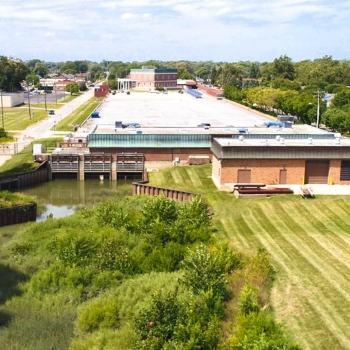
The Oakland County Water Resources Commissioner (WRC) was confronting two complex challenges when it partnered with OHM Advisors to track per- and polyfluoroalkyl substances (PFAS) sources in wastewater flow to the Clinton River. The Clinton River Water Resource Recovery Facility (CRWRRF) had agreed to begin accepting the flow of 9 million gallons of wastewater per day that had previously flowed to Great Lakes Water Authority (GLWA), and also took on responsibility for regulating the industrial dischargers in five associated communities. Simultaneously, the Michigan Department of Environment, Great Lakes, and Energy (EGLE) was implementing new regulations on PFAS in wastewater discharges. When the new connection was brought online at CRWRRF, the effluent PFAS concentrations climbed above regulatory limits. CRWRRF was therefore required to identify potential sources, work with industrial users to minimize those discharges, and reduce PFAS levels in its discharge to the Clinton River.
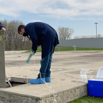
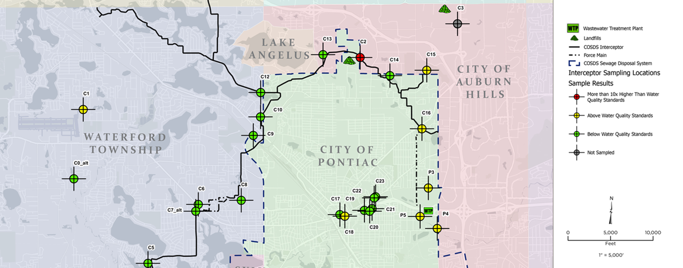
When CRWRRF surveyed its industrial users, two landfills were found to be discharging PFAS to its system, but the total mass observed in the effluent exceeded that of the landfills and the WRC engaged our team to track PFAS sources. There were too many potential sources in the 120 square miles of collection system to explore them individually, so our team created an innovative approach to source tracking. We isolated individual branches of the collection system by sampling at lift stations, major system intersections and existing flow meters. In this way, we could identify the sewer branches where PFAS concentrations were detected above water quality standards, and then convert those concentrations to mass to isolate the priority branches carrying the largest total mass.
Our team analyzed the sampling data and created detailed maps of six priority areas overlaid by information on sources with a high likelihood of carrying PFAS compounds—industrial dischargers, airports, sites with documented groundwater contamination consistent with PFAS use, and metal-related manufacturers. These locations were pared down to identify those with the highest likelihood of PFAS discharge for follow-up sampling. The most significant identified sources were six landfills, (four transferred from GLWA) that collectively contributed over half of the total PFOS and most of the PFOA mass sent to CRWRRF.
This forward-thinking evaluation demonstrates WRC’s commitment to meeting state water quality standards for the 30 million gallons of water treated daily by CRWRRF. The evaluation results enabled WRC to focus compliance efforts on a handful of significant dischargers (thereby reducing staff workload); to support CRWRRF in achieving consistent compliance with the state’s water quality standards; and to minimize PFAS discharge, protecting the quality of water released to the Clinton River and the overall public health.
Project Highlights: environmental engineering, water quality monitoring, PFAS evaluation, PFAS source tracking