Skip to main content
Mapping Water Quality to Track Contamination to the Source
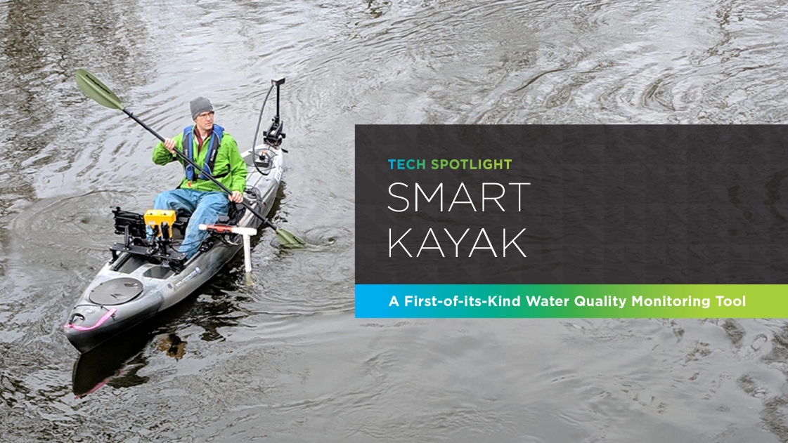
OHM Advisors’ first-in-the-industry Smart Kayak is our newest tool for field evaluation of surface waters, mapping water quality to make the invisible, visible. The Smart Kayak collects a continuous, in-depth data set of water quality parameters.
Analysis of this data can identify the entry points of harmful contaminants into watersheds and inform recommended solutions. The heat maps created by the Smart Kayak can be used as a communication tool to inform the public, raising awareness of water quality issues and generating buy-in for treatment options and infrastructure improvements.
How the Smart Kayak Works
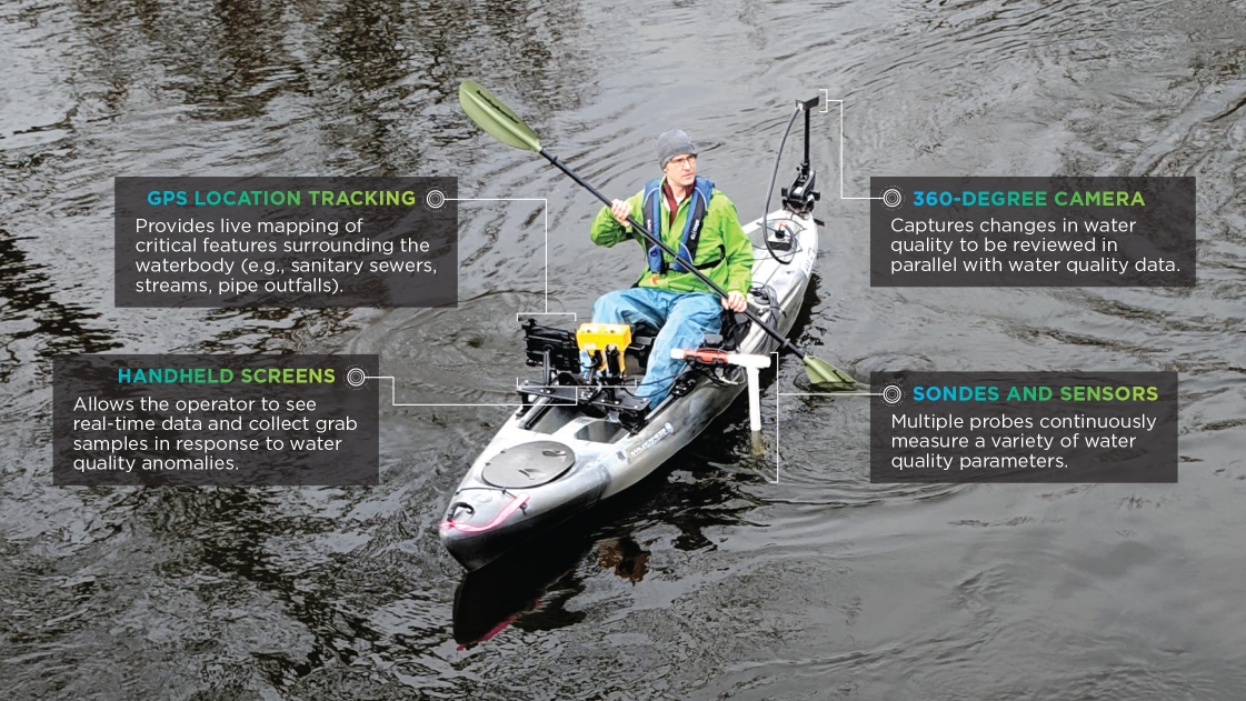
Cutting-edge monitoring probes that can measure water quality indicators as fast as once per second are mounted on the motorized kayak, which is also equipped with GPS positioning and a 360° camera. Manned by our team, the kayak’s probes continuously analyze water quality parameters, pairing them with GPS locations to create spatial data on heat maps.
This allows for an understanding of water quality throughout an entire stretch of river or lake instead of just collecting information at specific points. When the probes observe any increases in water quality indicators, the team collects traditional samples for laboratory analysis and documents the location using the 360° camera and GPS data to help identify possible sources of contamination.
The Smart Kayak identifies illegal discharges, leaking sewers, and stormwater runoff to identify contamination sources.
The Smart Kayak in Action
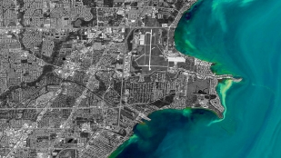
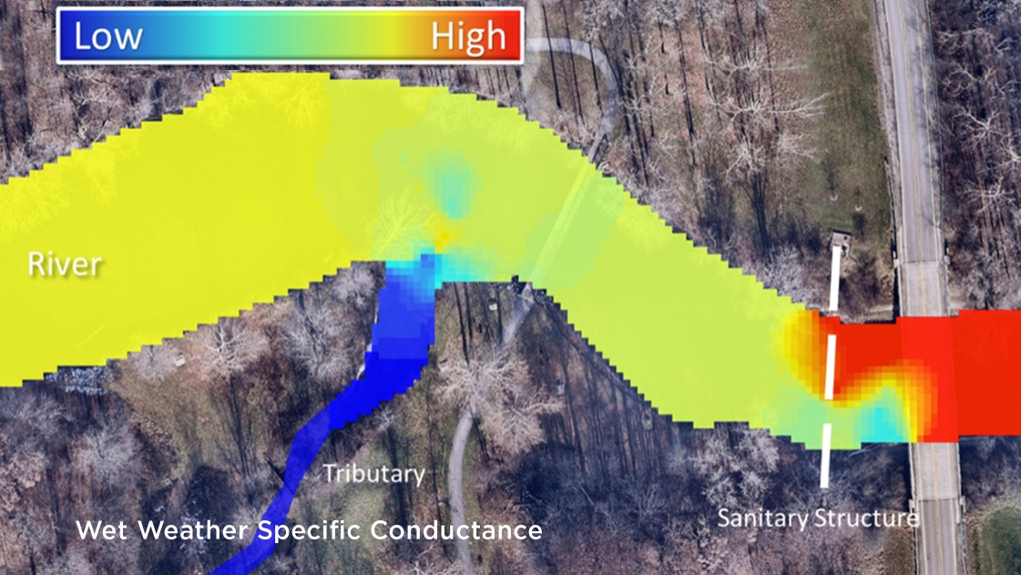
A client received reports of an unpleasant, sewage-like smell and possible pollution on a stretch of river indicated in the pictured heat maps. OHM Advisors’ Smart Kayak team analyzed the river in that area on both dry and wet weather days to determine the possible causes.
Our team collected data from multiple parameters in the area, including specific conductance, which is a metric for determining how well water conducts electricity. Human impacts like sewage or other pollution usually cause an increase in specific conductance, so our team analyzed where such increases might be occurring. We measured specific conductance on a dry weather day with little to no water input and slow water velocity, and a wet weather day with an increased amount of rainwater input increasing water velocity.
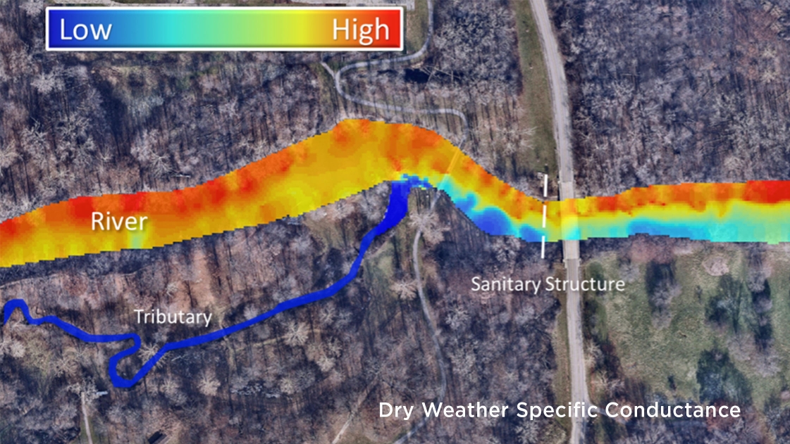
The dry weather heat map above shows moderate specific conductance in most of the river, while the tributary to the south shows very low specific conductance. The wet weather map below shows lower specific conductance in much of the river, likely due to the increased rainwater entering the river in this relatively naturalized area. Just downstream, a sanitary structure runs under the river, and at this location, the map shows a significant increase in specific conductance. This pattern is consistent with a leak in the structure discharging into the river and causing the offending smell. The heat map suggests that the leak is likely on the north side of the river, where the red plume originates. Our team used these results to recommend inspection and repair of this structure to prevent future leaks.
The production of specific conductance heat maps is just one real-world example of what OHM Advisors’ Smart Kayak technology can accomplish. And the Smart Kayak is just one tool in a whole suite of scalable, field-ready water quality monitoring solutions under the umbrella of OHM Advisors' GLASSES initiative that our team can use to help communities identify harmful pollutants and plan for improvements.
About OHM Advisors’ GLASSES Initiative: The Great Lakes Automated Sampling Solutions and Evaluation System (GLASSES) is a smart technology initiative integrating innovative detection methods, telemetry and cloud-based data analytics to greatly expand water quality monitoring capabilities. Users can view continuous real-time water quality data through a user-friendly analytics platform to provide new levels of insight for more effective decision making. For more information, contact team leader Karlin Danielsen, Ph.D. at (734) 522-6711.